Overview
Change detection capabilities are highly sought after by government and non-government entities. Tools that can automatically process satellite imagery and temporally compare the change that has happened in a given region open up a plethora of possibilities. GA-CCRi is interested in setting up its very own change detection algorithm that can reflect when industrialization happens and detect other geographical changes that occur in regions around the world. Through the use of computer vision and deep learning this alogrithm can result in a very robust tool for GA-CCRi.
Model
In order to create the most beneficial tool, supervised and self-supervised methods were explored by GA-CCRi analysts. Under the supervised methods, different network architectures were identified and trained on EarthNet2021 and EuroSAT data. Triplet loss was added to the architecture in order to pursue self-supervised methods. Overall, the tool was capable of detecting landscape changes on LandSAT imagery boasting a 30 meter ground sampling distance as seen in the example below.
Our Goal
Use high resolution Maxar imagery to perform more accurate and specific change detection as a secondary step.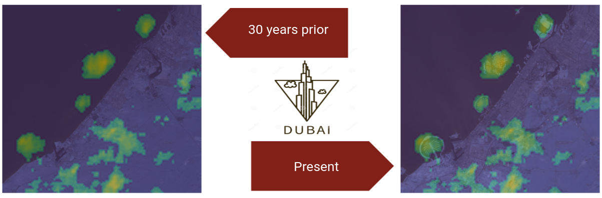
Timeline
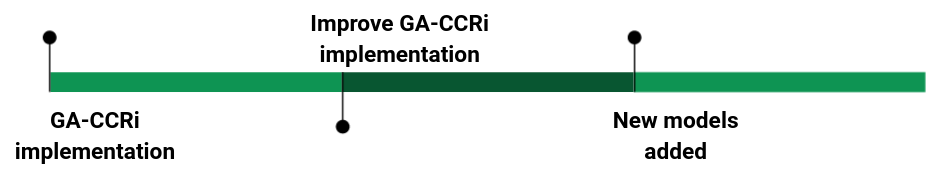

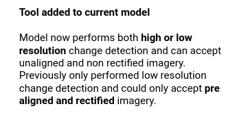

Whats New
One of the very pertinent things we did for this project is improve upon the GA-CCRi tool by modifying it to accept inputs from any satellite and detect change in images that were not prealigned with eachother. The tool that was already available was too limiting because it could only accept LandSat imagery as input and the images had to be orthorectified and aligned prior to their use. This is unrealistic given the fact that most satellite imagery is captured off-NADIR or at an angle.
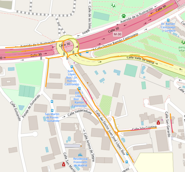
*Outputs include lat/lon values
that can be overlaid atop of a
map. Every color is for a
different road class*
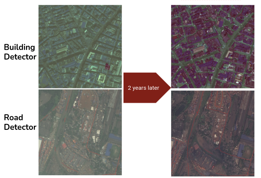
The most impressive additon provided to GA-CCRi was a road and building detector. These road and building detectors are state of the art. For example, the road detector is an ensemble of 4 different Unets and 4 different Resnet models. Unfortunately, the detectors didnt give optimal performance since they werent trained on a large high-res dataset. If properly trained, the performance will significantly increase.
Future Work
Retrain and automate.
One of the first things that needs to be done is retraining. After acquiring a high resolution dataset, the road and building detectors can be retrained to more accurately predict where buildings and roads are in images of different ground sampling distances. Since most of the data will be retrieved from MAXAR, it is important to include a large set of 30 cm per pixel imagery. Additionally, this tool can be automated to work on live imagery quickly comparing change over several different time periods succesfully predicting where urbanization is occuring.
New Data.
Different data sources like well known text with latitude and longtitude values for where roads already exist on a map can be used to make the model more robust and as a validation metric during training.